


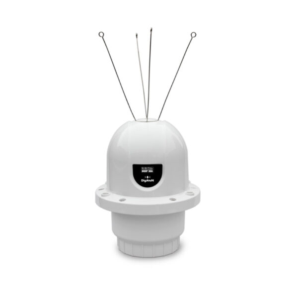
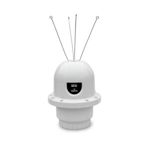
DiGAToN – AIS AtoN
“AtoNs fit to marine structures, hazards, buoys or can be configured to represent a virtual or synthetic point if mounted remotely from a physical location. AIS equipped vessels and shore stations can then not only identify the position of these marks but also read data
- Description
- Manuals & Downloads
- What's in the Box
Description
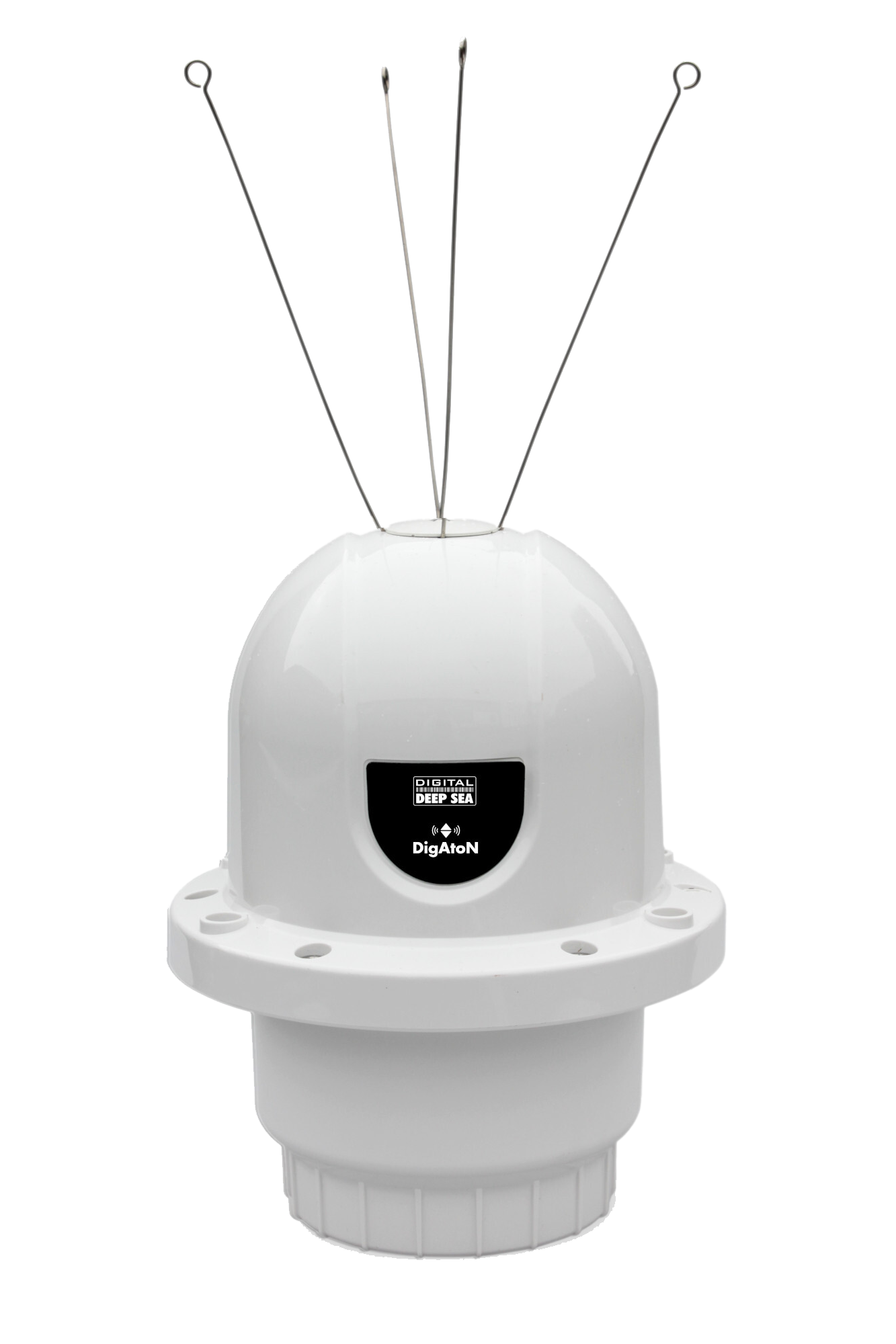
DiGAToN
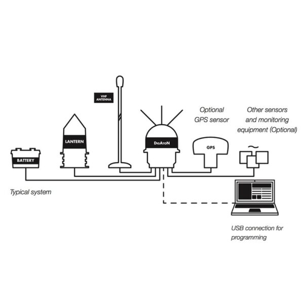
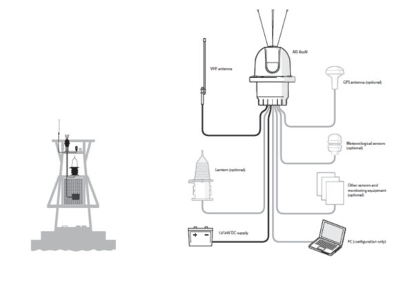
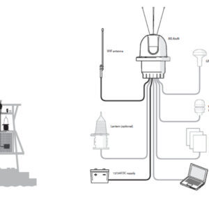
AtoNs fit to marine structures, hazards, buoys or can be configured to represent a virtual or synthetic point if mounted remotely from a physical location. AIS equipped vessels and shore stations can then not only identify the position of these marks but also read data - such as weather and instruments - collected by the AtoN.
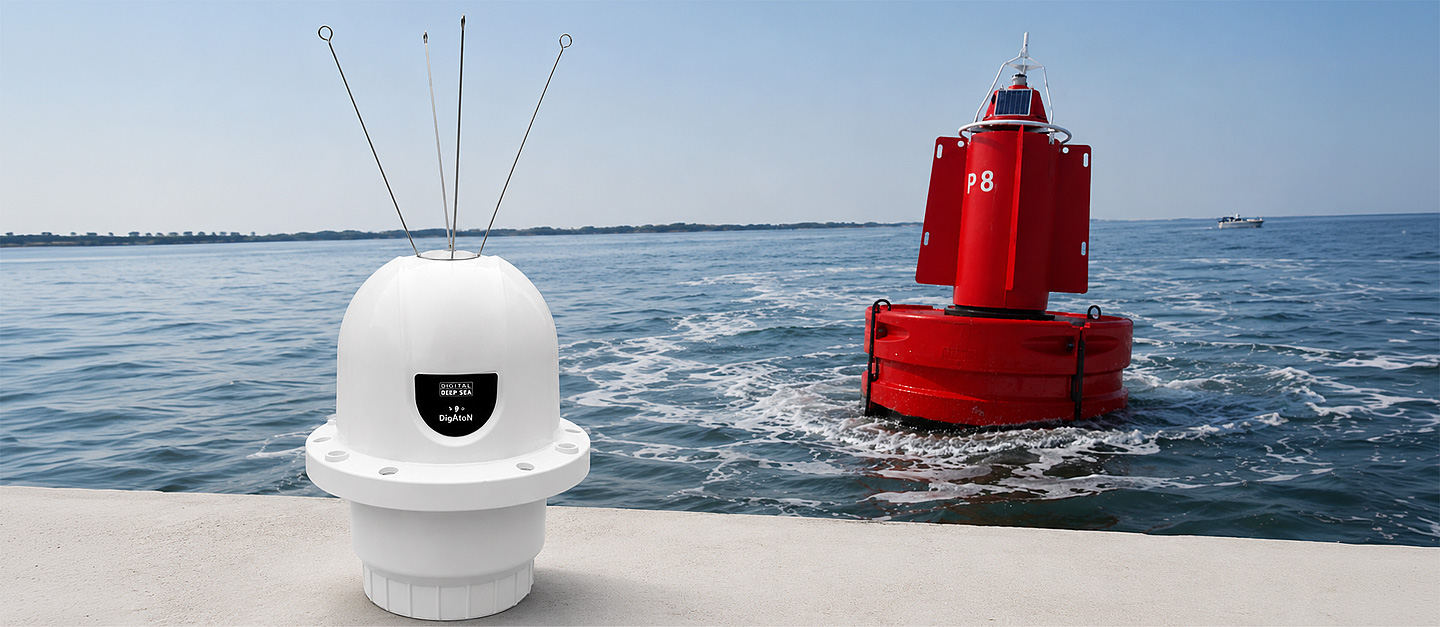
The digital revolution of navigation aid.
AtoN stands for Aid to Navigation – systems designed to assist mariners in determining their position, safely navigating waterways, and avoiding hazards. Traditionally, AtoNs include physical structures like buoys, lighthouses, and beacons.
AIS AtoN integrates traditional navigation aids into the AIS network, allowing them to broadcast their position and status electronically to nearby vessels and coastal stations. This enhances visibility, safety, and access to additional information such as weather, tide, or sea state data.
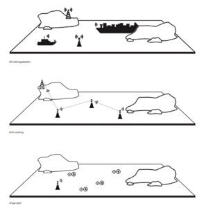
Physical, Virtual or Synthetic.
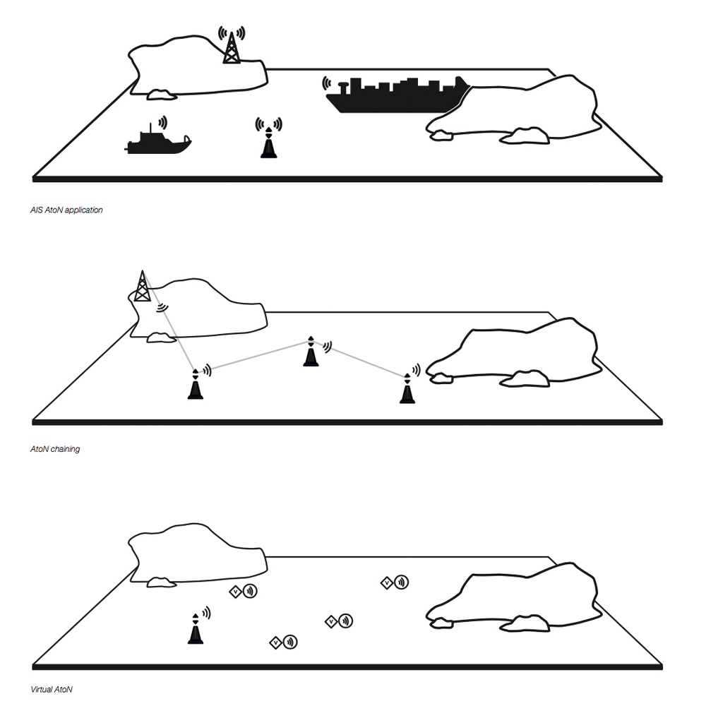
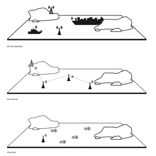
Though not classes, there are three types of AIS Aids to Navigation:
A Physical AtoN is an actual navigation aid fitted with AIS.
A Virtual AtoN has no physical presence – AIS Message 21 represents a non-existent aid.
A Synthetic AtoN is a real AtoN that exists, but the AIS message is transmitted from a remote station.
The DIGAToN supports all three modes, and can simultaneously represent up to 5 virtual points – ideal for yacht club racing or movable marks.
Class 1 or Class 3
CLASS 1
Transmit only
Class 1 devices transmit only AIS messages but require a local AIS base station to be operating in the same area as the AtoN.
CLASS 3
Transmit & receive
Class 3 devices transmit but also receive AIS messages. They can internally allocate slots for transmission, allowing them to be placed anywhere. They can also be remotely configured and monitored via the VHF Data Link (VDL), and wirelessly chained together for extended range.
OPTION
Extended sensor interface
Class 3 devices also transmit AIS Message 8, enabling the broadcast of meteorological, hydrological, operational and custom data to nearby vessels and AIS base stations.
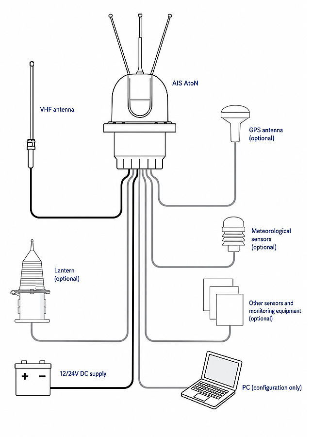
SPECIFICATIONS
What the datasheet says.
SENSOR INTERFACE (OPTION)
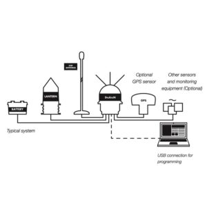
All models include dual NMEA interfaces and four user I/Os for light or racon health status.
Sensor interface models additionally feature:
3
2
5+5
2
RS232
RS422
SDI-12
1
APPLICATIONS
Suitable for a wide range of applications, including:
AIDS TO NAVIGATION
Broadcast AIS identity, position, and status for lighthouses, buoys, beacons, harbour entrances, and navigation channels, improving visibility and navigational safety in all conditions.
OFFSHORE INFRASTRUCTURE
Protect offshore wind farms, oil & gas platforms, bridges, and other fixed marine structures by clearly identifying their location and broadcasting AIS information to passing vessels.
VIRTUAL ATONS & RACE
Deploy virtual or synthetic AtoNs to mark temporary hazards, exclusion zones, dredging works, or sailing race courses. Create up to five virtual AIS marks without the need to deploy physical buoys.
REMOTE MONITORING & ENVIRONMENTAL DATA
Transmit operational, environmental, and custom sensor data via AIS Message 8. Remotely monitor lanterns, batteries, racons, buoy position, and broadcast wind, tide, current, wave, salinity and other site-specific measurements.
- AIS AtoN Transceiver
- Mounting Bracket & Fixings
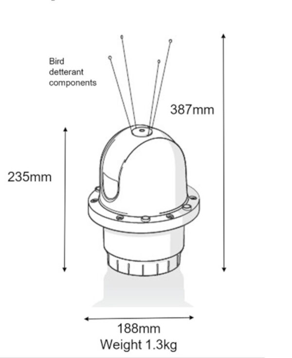
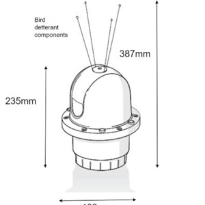
- Bird detterant components
- Product Manual
- USB Configuration Cable
- Power and Cable cable
- Sensor interface cables (optional)